On this day: Hiram Bingham reaches Machu Picchu
On 24 July 1911, the American academic Hiram Bingham was led up a ridge above the Urubamba river to Machu Picchu. He is often credited with discovering it, but local farmers were living on the site and guided him there.
On the morning of 24 July 1911 it was raining in the Urubamba valley in southern Peru. Hiram Bingham, a 35-year-old lecturer in Latin American history at Yale, crossed the river on a makeshift log bridge and climbed roughly 600 metres up a forested ridge with a Peruvian police sergeant and a local farmer who had offered to show him ruins. Near the top he found terraces cut into the mountainside and walls of fitted white granite running under moss and bamboo. Almost every account since has called this a discovery. It was not, and the details of that day explain why.
The farmer was Melchor Arteaga, who ran a small holding at Mandor Pampa and knew the ridge well. He agreed to guide Bingham for a fee, usually reported as one silver coin. Two families, the Richarte and Alvarez households, were living on the site and farming its ancient terraces, which they had cleared and planted because the drainage still worked after four centuries. A boy from one of the families walked Bingham through the best-preserved sector. Bingham also recorded seeing a name and a date carved on a wall in the Temple of the Three Windows: Agustin Lizarraga, 1902. Lizarraga was a local farmer who had reached the site nine years earlier. A German engineer's map published in Peru in 1874, by Herman Gohring, had already printed the names Machu Picchu and Huayna Picchu.
So what Bingham did was not find an unknown place. He arrived with a Yale expedition, a camera, funding and access to journals and lecture halls, and he turned a site known locally and named on a map into a global name. That distinction is not a technicality. It is the difference between a place being lost and a place being ignored by the people who write the books.
He was also looking for something else. Bingham wanted Vilcabamba, the refuge in the eastern forests where Inca resistance continued for nearly 40 years after the Spanish invasion, until the execution of Tupac Amaru in 1572. He concluded that Machu Picchu was Vilcabamba, and at other times argued it was Tampu Tocco, a place named in Inca origin stories. Both identifications were wrong. He had actually passed through the real Vilcabamba at Espiritu Pampa on the same 1911 journey and dismissed it, and the site was only properly identified in the 1960s after work by the explorer Gene Savoy.
What Machu Picchu actually is has become much clearer since. It was built around 1450, in the reign of the Inca ruler Pachacuti, as a royal estate rather than a city: a retreat and ceremonial complex of roughly 200 structures on a saddle between two peaks at about 2,430 metres. Its Quechua name means old peak. A permanent staff of a few hundred lived there, with more arriving when the court did. It fell out of use in the 1500s, during the collapse brought by conquest, smallpox and civil war, and Spanish forces never reached it, which is why the buildings survived without being dismantled for churches.
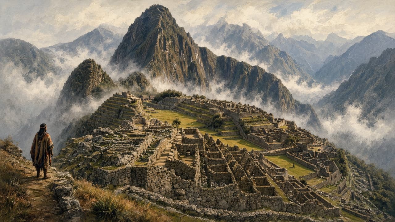
The construction is worth teaching because it explains the survival. Inca masons cut granite blocks to fit each other without mortar, a technique called ashlar masonry, so joints can flex slightly in an earthquake and settle back. Doors, windows and niches are trapezoidal and walls lean inward, both of which resist shaking. More than 700 terraces hold the slopes in place and are built in layers of stone, gravel and soil that carry water down rather than letting it pool. Around 130 drainage channels run through the site. A canal roughly 750 metres long brings spring water from the flank of Machu Picchu mountain to a chain of 16 fountains. The carved Intihuatana stone and a window in the Temple of the Sun align with the solstices, which tells you the estate was also an instrument for tracking the agricultural year.

Bingham returned with larger expeditions in 1912 and in 1914 and 1915, backed by Yale and the National Geographic Society, whose April 1913 issue devoted almost the entire magazine to the site. Crews cleared the vegetation, mapped the buildings and excavated burials. Somewhere between 4,000 and 5,000 objects and sets of human remains went to the Peabody Museum in New Haven, described at the time as loans. Peru spent most of the following century asking for them back. Yale and the Peruvian government reached agreement in 2010 and 2011, and the returns were completed by 2012 to a museum at the Casa Concha in Cusco.
Bingham left archaeology for politics, serving briefly as governor of Connecticut and then as a United States senator, where he was censured in 1929 over a lobbyist on his payroll. His 1948 book Lost City of the Incas sold widely and cemented the myth his own field notes contradict. Modern Peruvian scholarship, and pointed local memory, has been correcting it ever since. The luxury train that runs to the site is still named after him.
The site is now managed as a fragile asset. UNESCO listed it in 1983, an internet vote in 2007 named it one of the new seven wonders, and visitor numbers passed 1.5 million a year before 2020. Entry is capped at a few thousand a day on fixed circuits with timed tickets, partly to protect the stonework and partly because the ridge is prone to landslides. Disputes over who sells tickets and how revenue reaches the towns below have closed the site briefly more than once in recent years. Peru now uses the official name Llaqta of Machupicchu.
Eagle Frame's takeaway: 24 July 1911 is a good date for testing the word discovery. Bingham deserves credit for the excavation, the mapping and the publicity that protected the site, and the family farming its terraces that morning deserves the correction. A place is not found the moment an outsider writes it down.